The Importance of High-Resolution Surveys in Salvage and Wreck Removal Operations
The maritime industry, despite its vast advancements in technology and safety, is not immune to accidents and incidents. Whether due to navigational errors, adverse weather conditions, or mechanical failures, shipping incidents leading to vessel groundings, collisions, or sinkings occur from time to time. In the aftermath of such events, salvage operations and wreck removal become critical to prevent environmental damage, minimise economic loss, and ensure the safety of maritime routes. One essential tool that has revolutionised these efforts is the use of high-resolution surveys.
High-resolution surveys refer to advanced techniques used to map the underwater environment with exceptional detail and accuracy. These surveys utilise cutting-edge technologies such as multi-beam sonar, side-scan sonar, photogrammetry and remotely operated vehicles (ROVs) to gather comprehensive data on the seafloor, submerged objects, and the wreck itself. The resolution and precision of the geo-referenced data acquired allows salvage teams to assess the site and plan operations with unprecedented clarity.
The significance of high-resolution surveys in salvage and wreck operations, lies in their ability to produce accurate 3D models of the underwater landscape and wreckage. This data is crucial for assessing the position, condition, and orientation of a sunken vessel or offshore platform, as well as identifying any potential hazards or obstacles on the seafloor that could impact salvage efforts. The survey results serve as the foundation for strategic decision-making and the preparation of realistic proposals for remediation ensuring that operations are carried out safely, efficiently, and with granularity of cost, whilst remaining in compliance with environmental regulations.
Benefits of High-Resolution Surveys in Salvage Operations
- Accurate Site Assessment
High-resolution surveys provide precise information on the location of the wreck, the extent of structural damage, and the condition of the seabed. This data helps salvage teams understand the scope of the operation and develop effective strategies for lifting or dismantling the wreckage. - Enhanced Planning and Risk Management
Salvage operations often involve significant risks, especially for divers working in deep waters navigating complex environments. These surveys allow salvage teams to identify potential hazards, such as underwater obstructions, the nature of the seabed and to derive situational awareness not possible by other means. By having detailed information on these factors, salvage teams can mitigate risks, optimise resources, and reduce the likelihood of accidents during the recovery process. - Efficiency and Cost Savings
With detailed survey data in hand, salvage teams can plan and execute operations more efficiently. Accurate data reduces the need for guesswork, enabling precise placement of equipment such as cranes, barges, and cutting tools. This not only speeds up the recovery process but also minimises the time spent on-site, which translates into significant cost savings. In large-scale wreck removal projects, these efficiencies can have a substantial impact on the overall budget. - Environmental Protection
One of the primary concerns during wreck removal operations is preventing environmental damage. High-resolution surveys help salvage teams identify sensitive marine ecosystems, such as coral reefs or underwater habitats, that must be protected during the operation. By understanding the seafloor’s topography and potential environmental risks, salvage teams can design operations that minimise disturbance and reduce the risk of fuel spills, chemical leaks, or other environmental hazards. - Post-Salvage Evaluation
High-resolution surveys are not only useful for the initial assessment and planning of salvage operations; they also play a crucial role in post-salvage evaluations. After the wreck has been removed, surveys can be conducted to ensure that the seafloor has been properly cleared and that no debris remains. This post-salvage data can also be used to verify that environmental standards were met, and that the operation was conducted without causing lasting harm to the marine ecosystems.
High-resolution surveys provide valuable information for planning the cutting, lifting, and transportation of large sections of wreckage, especially when dealing with complex, deep-water environments.
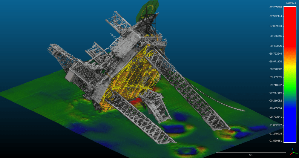
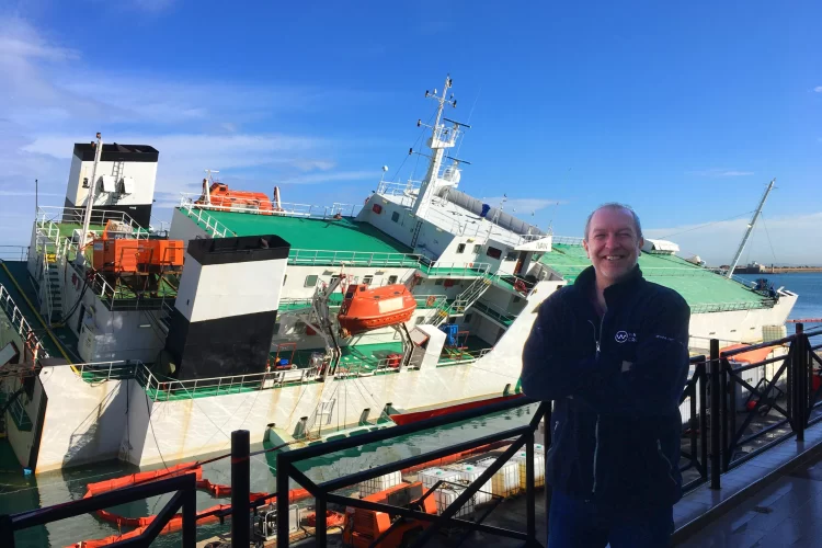
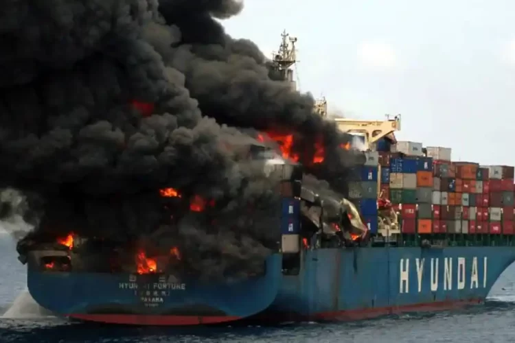
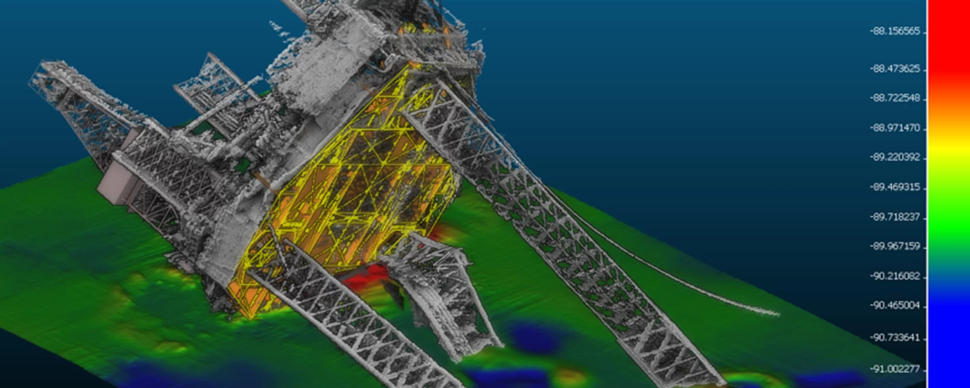
For example, during the wreck removal of the Costa Concordia off the coast of Italy, high-resolution surveys were pivotal in mapping the position and orientation of the vessel and provided detailed information about the damage that occurred to the starboard side whilst capsized. The data allowed engineers and naval architects to design a plan for the initial parbuckling, followed by the refloating and towing of the ship in an environmentally safe manner. Similarly, in other high-profile wreck removal projects, such as that of the NAGA 7 (pictured) in the South China Sea, accurate 3D survey data was instrumental in the wreck removal process, allowing detailed calculations to be made for fuel removal in the first instance and then the cutting of the structure and subsequent lifting of the sections from the seabed.
High-resolution surveys are a cornerstone of success in modern salvage operations, providing detailed, accurate, and actionable data that enhances safety, efficiency, and environmental responsibility. Advances in survey technology are delivering even greater accuracy, with autonomous underwater vehicles (AUVs) and remotely operated vehicles (ROVs) now able to gather data in extreme depths and challenging conditions. Coupled with 3D visualisation and AI-driven data processing, these tools enable faster interpretation and more streamlined decision-making, making salvage operations safer and more effective.
Waves Group has extensive experience in undertaking high-resolution surveys in support of numerous salvage operations, including the Costa Concordia, Rena, Sewol, Baltic Ace, , Northguider, Naga 7 and many others. We are dedicated to solving maritime challenges through digital technology, enhancing situational awareness and increasing the certainty of outcomes. Our innovation strategy focuses on capturing real-world data above and below water, which we combine with advanced visualisation techniques and the expertise of our marine team, including Naval Architects, Master Mariners, and Structural Engineers, to improve understanding and communication. This approach offers clients greater certainty, particularly with complex, hard-to-reach objects like underwater casualties or damaged subsea cables, underscoring Waves Group’s commitment to delivering confidence, precision, and reliable results.
To learn more about our digital capabilities, please contact us at [email protected] or +44 (0) 20 7083 7266.
